


Discover a revolutionary web-based road update system using Google Maps API, offering real-time information on road conditions, accidents, and construction.
Authors: Benzar Glen S. Grepon, Northern Bukidnon State College, Philippines ben.it2c@gmail.com ; JC P. Margallo, Northern Bukidnon State College, Philippines; Jonathan B. Maserin, Northern Bukidnon State College, Philippines; Rio Al-Di A.
Dompol, Northern Bukidnon State College, Philippines. Table of Links Abstract and Intro Literature Review Methodology Results Discussions Conclusions Recommendations Research Implications Practical Implications Declarations References and Author's Biography Abstract Purpose – Knowing the current situation on every road in an area is still difficult to anticipate. Commuters, riders, and drivers are still dependent on road situations from a local news agency to be well informed and be updated on possible road updates such as vehicular accidents, government road and bridge projects/construction, and other related road obstructions. To give solutions regarding road updates, a web-based roads update information system has been developed that uses Google Maps API allowing people to view and be notified of the real-time updates of the road situation of a specific area. Method - This paper discusses the main system functionalities, including sub-systems and modules of the system, the research approach and methodology, which is the Agile Model, and its impact on disseminating road information and its status. Results – The project has been evaluated using ISO 25010, a quality evaluation system for product/software measuring its functionality, efficiency, reliability, usability, security, maintainability, and portability. Based on the evaluation result, the project has been rated 4.21, signifying an excellent performance based on qualitative description through a Likert scale descriptive interpretation. The project has been running and hosted on the world wide web and is expected to expand its coverage area from its origin country to the rest of the world. Conclusion – Based on the initial findings of the study, the respondents agreed that the developed web system was functional and a massive help to commuters, riders, and people who travel a lot. The system's overall effectiveness and performance were excellent based on the criteria set by ISO/IEC 25010. Recommendations – It is recommended for future development to expand the coverage of the road updates, if possible, including the entire Philippine archipelago for long-drive commuters and drivers to be more updated in terms of road updates. Also, include the use of mobile applications for more user-friendly design and interactions. Research Implications – The study allows viewing and reporting road updates with attachments as proof, informing commuters about what to expect when they travel. The system has been implemented in the municipality of Bukidnon and has been updated now and then for continuous quality improvement. Practical Implications – The main benefit that the Road Updates Information System can do is to inform people who are constantly traveling to be updated on the current situation of a specific road by accessing the system and checking the map on areas to travel and see for themselves the photos and description of a place where road construction, accidents and other causes that delay the traveling time of passengers and travelers. Aside from being informed of the road updates, citizens can also participate by uploading photos and descriptions of what is still going on the roads to the system and be viewed by people who try to access the web portal. Keywords – Road Updates, Information System, Google Maps, Web App, Web Portal, Philippines INTRODUCTION With growing municipality dwellings, expanding roots of human settlements, and the complex urbanization happening all over, the way we find our way through routes and off-the-routes is getting tougher. This is why navigation apps are growing in prominence and scope to help us better read, predict, and pierce through streets and directions . People use navigating apps as their primary information access to familiar and unfamiliar destinations or personal routes . Knowing the current situation of a particular place, especially road conditions, and updates, is difficult to monitor with the existing navigation apps. The problem began when smartphone apps like Waze, Apple Maps, and Google Maps came into widespread use, offering drivers real-time routing around traffic tie-ups; an estimated 1 billion drivers worldwide use such apps. Now that online navigation apps are in charge, they are causing more problems than they solve . In the case of the Philippines and experienced in other countries, there are a lot of on-going situations that cause delays to commuters and travelers’ day by day. This situation has inspired the proponents to design and develop a Road Updates Information System. It's still challenging to predict the state of every road in each area. To stay informed about potential road updates such as traffic accidents, governmental road and bridge projects/construction, and other associated road impediments, commuters, riders, and drivers continue to rely on the road status provided by a local news organization. Traveling without the idea of what's going on ahead will make the traveling riskier; for example, planning to go somewhere where there is ongoing rescue operation because of the landslide currently happening or delay because there are roads and bridges needed to be repaired, these incidences will undoubtedly delay the traveling time and expectations of a particular traveler or commuter which may affect their transactions, vacations or any essential dealings. Fortunately, the proposed system has the capabilities to help riders, drivers, commuters, or even ordinary people to be able to navigate the map through a web application and be updated on what's happening, aside from being informed those who were in the actual site where accidents happened, landslide and other factors which delay the passing by of vehicles in certain places can participate by updating the map and upload pictures and information to update the maps with the present situation. This web app uses Google Maps API to locate the exact location of a condition that causes the delay and inform all web app users of the situation, then giving them the decision whether to continue to travel or reroute to other alternative routes to avoid being congested where any incidences happen. This paper is available on arxiv under CC 4.0 license. Authors: Benzar Glen S. Grepon, Northern Bukidnon State College, Philippines ben.it2c@gmail.com ; JC P. Margallo, Northern Bukidnon State College, Philippines; Jonathan B. Maserin, Northern Bukidnon State College, Philippines; Rio Al-Di A. Dompol, Northern Bukidnon State College, Philippines. Authors: Authors: Benzar Glen S. Grepon, Northern Bukidnon State College, Philippines ben.it2c@gmail.com ; JC P. Margallo, Northern Bukidnon State College, Philippines; Jonathan B. Maserin, Northern Bukidnon State College, Philippines; Rio Al-Di A. Dompol, Northern Bukidnon State College, Philippines. Table of Links Abstract and Intro Abstract and Intro Literature Review Literature Review Methodology Methodology Results Results Discussions Discussions Conclusions Conclusions Recommendations Recommendations Research Implications Research Implications Practical Implications Practical Implications Declarations Declarations References and Author's Biography References and Author's Biography Abstract Purpose – Knowing the current situation on every road in an area is still difficult to anticipate. Commuters, riders, and drivers are still dependent on road situations from a local news agency to be well informed and be updated on possible road updates such as vehicular accidents, government road and bridge projects/construction, and other related road obstructions. To give solutions regarding road updates, a web-based roads update information system has been developed that uses Google Maps API allowing people to view and be notified of the real-time updates of the road situation of a specific area. Purpose Method - This paper discusses the main system functionalities, including sub-systems and modules of the system, the research approach and methodology, which is the Agile Model, and its impact on disseminating road information and its status. Method Results – The project has been evaluated using ISO 25010, a quality evaluation system for product/software measuring its functionality, efficiency, reliability, usability, security, maintainability, and portability. Based on the evaluation result, the project has been rated 4.21, signifying an excellent performance based on qualitative description through a Likert scale descriptive interpretation. The project has been running and hosted on the world wide web and is expected to expand its coverage area from its origin country to the rest of the world. Results Conclusion – Based on the initial findings of the study, the respondents agreed that the developed web system was functional and a massive help to commuters, riders, and people who travel a lot. The system's overall effectiveness and performance were excellent based on the criteria set by ISO/IEC 25010. Conclusion Recommendations – It is recommended for future development to expand the coverage of the road updates, if possible, including the entire Philippine archipelago for long-drive commuters and drivers to be more updated in terms of road updates. Also, include the use of mobile applications for more user-friendly design and interactions. Recommendations Research Implications – The study allows viewing and reporting road updates with attachments as proof, informing commuters about what to expect when they travel. The system has been implemented in the municipality of Bukidnon and has been updated now and then for continuous quality improvement. Research Implications Practical Implications – The main benefit that the Road Updates Information System can do is to inform people who are constantly traveling to be updated on the current situation of a specific road by accessing the system and checking the map on areas to travel and see for themselves the photos and description of a place where road construction, accidents and other causes that delay the traveling time of passengers and travelers. Aside from being informed of the road updates, citizens can also participate by uploading photos and descriptions of what is still going on the roads to the system and be viewed by people who try to access the web portal. Practical Implications Keywords – Road Updates, Information System, Google Maps, Web App, Web Portal, Philippines Keywords INTRODUCTION With growing municipality dwellings, expanding roots of human settlements, and the complex urbanization happening all over, the way we find our way through routes and off-the-routes is getting tougher. This is why navigation apps are growing in prominence and scope to help us better read, predict, and pierce through streets and directions . People use navigating apps as their primary information access to familiar and unfamiliar destinations or personal routes . Knowing the current situation of a particular place, especially road conditions, and updates, is difficult to monitor with the existing navigation apps. The problem began when smartphone apps like Waze, Apple Maps, and Google Maps came into widespread use, offering drivers real-time routing around traffic tie-ups; an estimated 1 billion drivers worldwide use such apps. Now that online navigation apps are in charge, they are causing more problems than they solve . In the case of the Philippines and experienced in other countries, there are a lot of on-going situations that cause delays to commuters and travelers’ day by day. This situation has inspired the proponents to design and develop a Road Updates Information System. It's still challenging to predict the state of every road in each area. To stay informed about potential road updates such as traffic accidents, governmental road and bridge projects/construction, and other associated road impediments, commuters, riders, and drivers continue to rely on the road status provided by a local news organization. Traveling without the idea of what's going on ahead will make the traveling riskier; for example, planning to go somewhere where there is ongoing rescue operation because of the landslide currently happening or delay because there are roads and bridges needed to be repaired, these incidences will undoubtedly delay the traveling time and expectations of a particular traveler or commuter which may affect their transactions, vacations or any essential dealings. Fortunately, the proposed system has the capabilities to help riders, drivers, commuters, or even ordinary people to be able to navigate the map through a web application and be updated on what's happening, aside from being informed those who were in the actual site where accidents happened, landslide and other factors which delay the passing by of vehicles in certain places can participate by updating the map and upload pictures and information to update the maps with the present situation. This web app uses Google Maps API to locate the exact location of a condition that causes the delay and inform all web app users of the situation, then giving them the decision whether to continue to travel or reroute to other alternative routes to avoid being congested where any incidences happen. This paper is available on arxiv under CC 4.0 license. This paper is available on arxiv under CC 4.0 license. available on arxiv
Sverige Senaste nytt, Sverige Rubriker
Similar News:Du kan också läsa nyheter som liknar den här som vi har samlat in från andra nyhetskällor.
 Google Maps makes it quick and easy to find charging stations for Electric VehiclesAlan, an ardent smartphone enthusiast and a veteran writer at PhoneArena since 2009, has witnessed and chronicled the transformative years of mobile technology. Owning iconic phones from the original iPhone to the iPhone 15 Pro Max, he has seen smartphones evolve into a global phenomenon.
Läs mer »
 Gemini comes to Google Maps Platform, allows devs to deliver concise AI-generated infoRado, a tech enthusiast with a love for mobile devices, brings his passion for Android and iPadOS to PhoneArena. His tech journey began with MP3 players and has evolved to include tinkering with Android tablets and iPads, even running Linux and Windows 95 on them. Beyond tech, Rado is a published author, music producer, and PC game developer.
Läs mer »
 Google Rolls out New Accessibility Feature That Lets You Talk by Staring At EmojisIn addition, Google Maps and Lookout will better describe objects in your environment.
Läs mer »
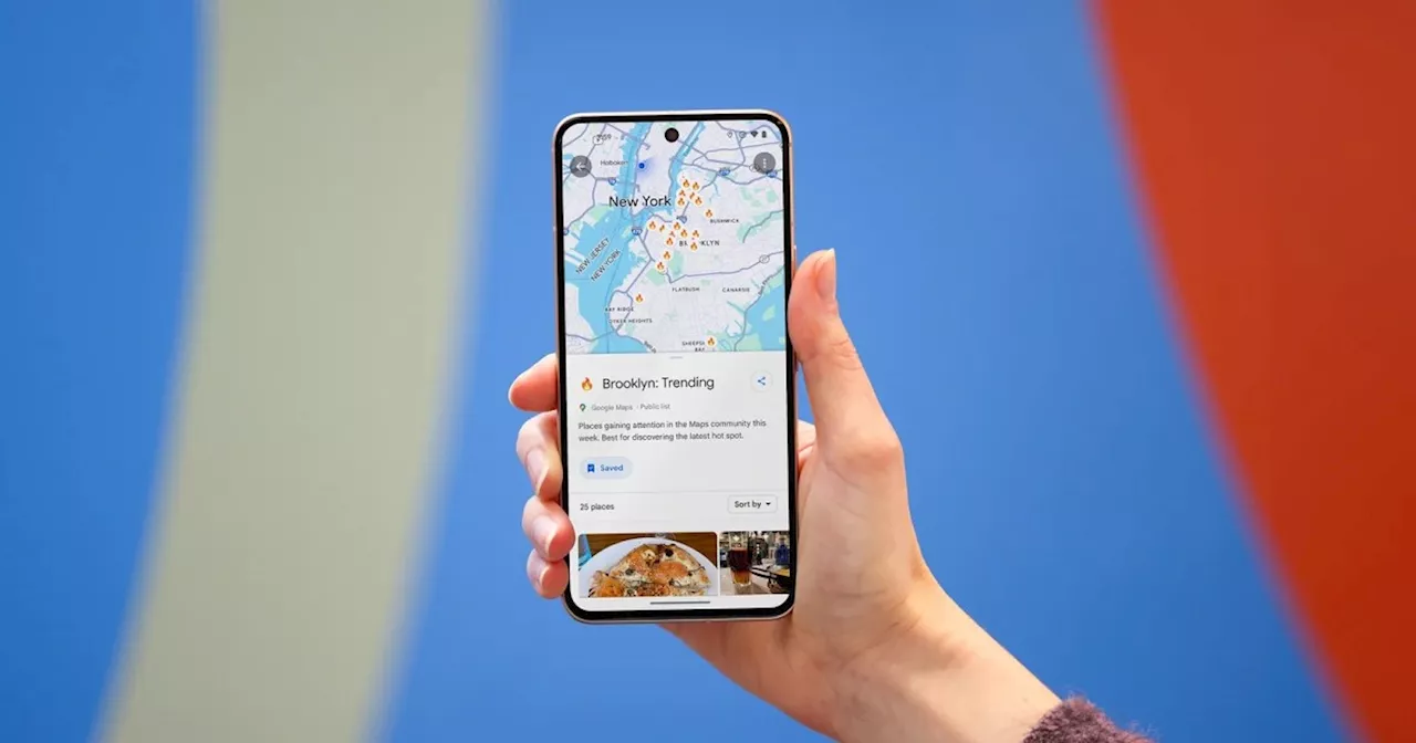 This is what Google Maps’ big redesign looks likeA redesigned Google Maps interface has several quality-of-life changes that have us excited. Here's what's new.
Läs mer »
 Google Maps getting AR integration later this yearAbdullah is an ardent believer in the future of VR, and can't wait to see what more it brings to the table as technology improves. He enjoys covering new software releases in the XR industry, as well as major news about hardware and companies focused on VR.
Läs mer »
 Google Maps Unveils simplified bottom bar and new 'You' tab in latest updateJohanna 'Jojo the Techie' is a skilled mobile technology expert with over 15 years of hands-on experience, specializing in the Google ecosystem and Pixel devices. Known for her user-friendly approach, she leverages her vast tech support background to provide accessible and insightful coverage on latest technology trends.
Läs mer »